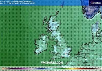
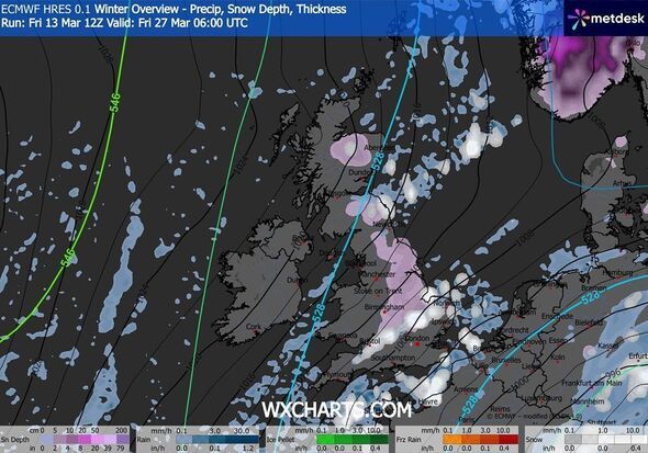
The UK may be set to experience more days of snowy weather as the latest maps show blizzards hitting as far south as Somerset in just a few weeks. WXChart weather maps, generated using MetDesk data on March 14, suggest that the temperature level will plummet to as low as -4C on March 27.
According to the weather charts, unsettled conditions will hit the country in a fortnight, with several parts of Britain being peppered with snow. The maps suggest that the wintry conditions will hit areas around Somerset, London, Bristol, Ipswic, Birmingham, Stoke on Trent and Manchester.
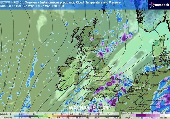
According to the maps, most of the towns and cities around London are likely to experience the lows of -2C on the same day.
In the north, areas around Dundee, Aberdeen and Glasgow will experience snow showers on March 27, with the temperature around Inverness plummeting to -4C, the maps have suggested.
Separately, the Met Office's long-range forecast between March 18 and 27 doesn't foresee any snow for now. It read: "Signs are that much of the UK will see a period of more settled weather for part of this period at least.
"Very early on, some wet and windy weather is likely across the far northwest but this will be short-lived. It is likely to quickly turn more settled everywhere, with most places predominantly dry.
"Temperatures will fluctuate between being milder than average to colder than average, so it is possible we could see some overnight frost and fog, but overall by day there should be spells of pleasant spring sunshine making it feel fine away from coasts exposed to a brisk easterly wind.
"How long the settled conditions last is less certain with some signals that showers / rain could return later in the period."
The Met Office previously explained forecasting snow in the UK is more complex than in continental Europe due to rapidly-changing conditions. Its website read: "Small variations in temperature or wind direction can mean the difference between rain, sleet or snow. Meteorologists use high-resolution models to predict precipitation type, but these models can struggle with marginal situations where temperatures hover around freezing.
"Forecasters also consider factors such as precipitation intensity. Heavy bursts of precipitation can cool the air near the surface, increasing the chance of snow. Conversely, lighter precipitation may melt before reaching the ground. This fine balance makes snow forecasting one of the most uncertain aspects of UK weather prediction."
Contact to : xlf550402@gmail.com
Copyright © boyuanhulian 2020 - 2023. All Right Reserved.