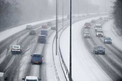
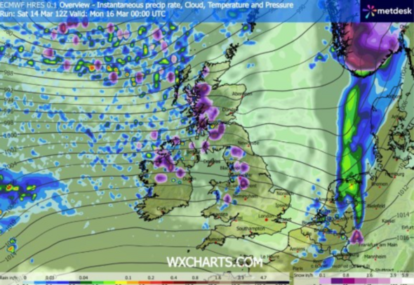
Brand new weather maps suggest one side of the UK could be covered by snow in the next few hours. The latest maps by WX Charts show a broad band of purple stretching across the western side of the UK, signalling snowfall from around 12pm today through to 9am tomorrow, a period of roughly 21 hours of wintry weather.
According to the maps, the worst of the conditions are expected across the Scottish Highlands, particularly in western Scotland. The system is expected to extend southwards, with the areas most affected including parts of North West England and western Wales and Northern Ireland, which are also expected to see snowfall.
Major towns and cities that could be affected by snow include Blackpool, Glasgow, Belfast, Manchester, and Dundee, according to the weather maps.
The Met Office's forecast for today reads: "Bright to start in the east but soon clouding over as rain continues to spread eastwards. Behind it, sunny spells and frequent blustery showers, these heavy at times and falling wintry over the hills. Coastal gales in the north."
For tonight, the Met Office said: "Rain continues to clear the southeast, with blustery showers persisting, especially in the northwest. These easing in the south by dawn with clear spells in between. Turning chilly.
And for Monday, the Met Office wrote: "Scattered showers to start, then cloud building with outbreaks of rain spreading across the country, though mostly dry in the far southeast. Breezy, especially along the hills and coasts."
The Met Office has previously stated how challenging it can be to forecast snow in the UK, especially more than a few hours in advance.
The Met Office previously said: "With a range of factors to consider, forecasting snow accurately in the UK can be one of the trickier forecasts to do accurately.
"Forecasting snow in the UK isn't like some other places along the UK's latitude, where snow can be quite reliably forecast days or weeks in advance.
"Because of the UK's location, where the air comes from is incredibly important when it comes to determining if snow is possible.
"Being surrounded by water also adds another factor into predicting snow chances in the UK, it may not feel like it if you dip your toe in, but the water in the seas around the UK is well above freezing and that affects the temperature of the air close to the surface which can determine how much snow is in the forecast.
"If there is significant snow in the forecast with a good degree of certainty, then Met Office National Severe Weather Warnings will help signal that there could be some impacts."
Contact to : xlf550402@gmail.com
Copyright © boyuanhulian 2020 - 2023. All Right Reserved.