The Met Office has named the areas of the UK facing hail, sleet and snow from Tuesday as weather conditions turn markedly colder.
Despite the UK recording its warmest day of the year so far last week, when a peak temperature of 20.9C was reached in Wales on Wednesday, the mild spring isn't forecast to last, as a drop in temperature is on the cards in the coming days. The Met Office has said the weather will be largely wet and windy on Tuesday, with parts of Northern Ireland and Wales facing heavy and persistent showers. Blustery showers are expected to move into Scotland and Northern Ireland, with hail and thunder also possible, as well as wintry showers over higher ground.
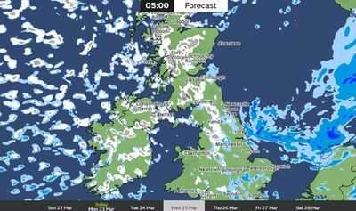
Met Office weather maps show some snowfall in parts of Scotland on Tuesday, including Strathyre, Loch Rannoch, Pitlochry, Fort William and Dalwhinnie, while large parts of North East England, North West England, East Midlands, Yorkshire and Humber and Wales face heavy rain.
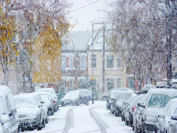
From Wednesday, weather conditions in all parts of the UK will feel much colder, with rain, sleet and hail showers forecast fairly widely, while snow is expected to fall over higher ground in the north.
Weather maps from the Met Office show snowfall across large areas of the UK on Wednesday morning, including parts of Scotland, Northern Ireland, North West England, Yorkshire and Humber, West Midlands and small areas of South East England.
Daytime temperatures will range from around 6C to 10C, but strong winds will make conditions feel much colder for many areas. Sub-zero temperatures are possible overnight on Wednesday, potentially reaching -5C in rural Scotland, resulting in widespread frost for much of the UK on Thursday morning, as well as possible ice in the north.
Drier and sunny conditions are forecast for most parts of the country on Thursday, although cloud and rain is expected to push into Northern Ireland and western areas later in the day.
From Friday onwards, temperatures will return closer to average, although the Met Office is warning further weather systems may strike at the weekend, but this is most likely to affect northern areas of the UK.
Met Office Deputy Chief Forecaster Steven Keates said: "After a spell of mild and brighter weather, the UK will turn increasingly unsettled in the coming days.
"A series of weather fronts will bring periods of rain, strong winds and much colder air by midweek. Wednesday could be quite a shock to the system. Temperatures will range from 6°C to 10°C, but it will feel closer to low single figures for many areas in the wind.
"Wintry showers are likely, especially over higher ground in the north, and a widespread frost - with icy patches for some - is possible on Wednesday night. It should be a little milder again by the end of the week, with many areas seeing another spell of rain on Friday."
Contact to : xlf550402@gmail.com
Copyright © boyuanhulian 2020 - 2023. All Right Reserved.